Vektor.io
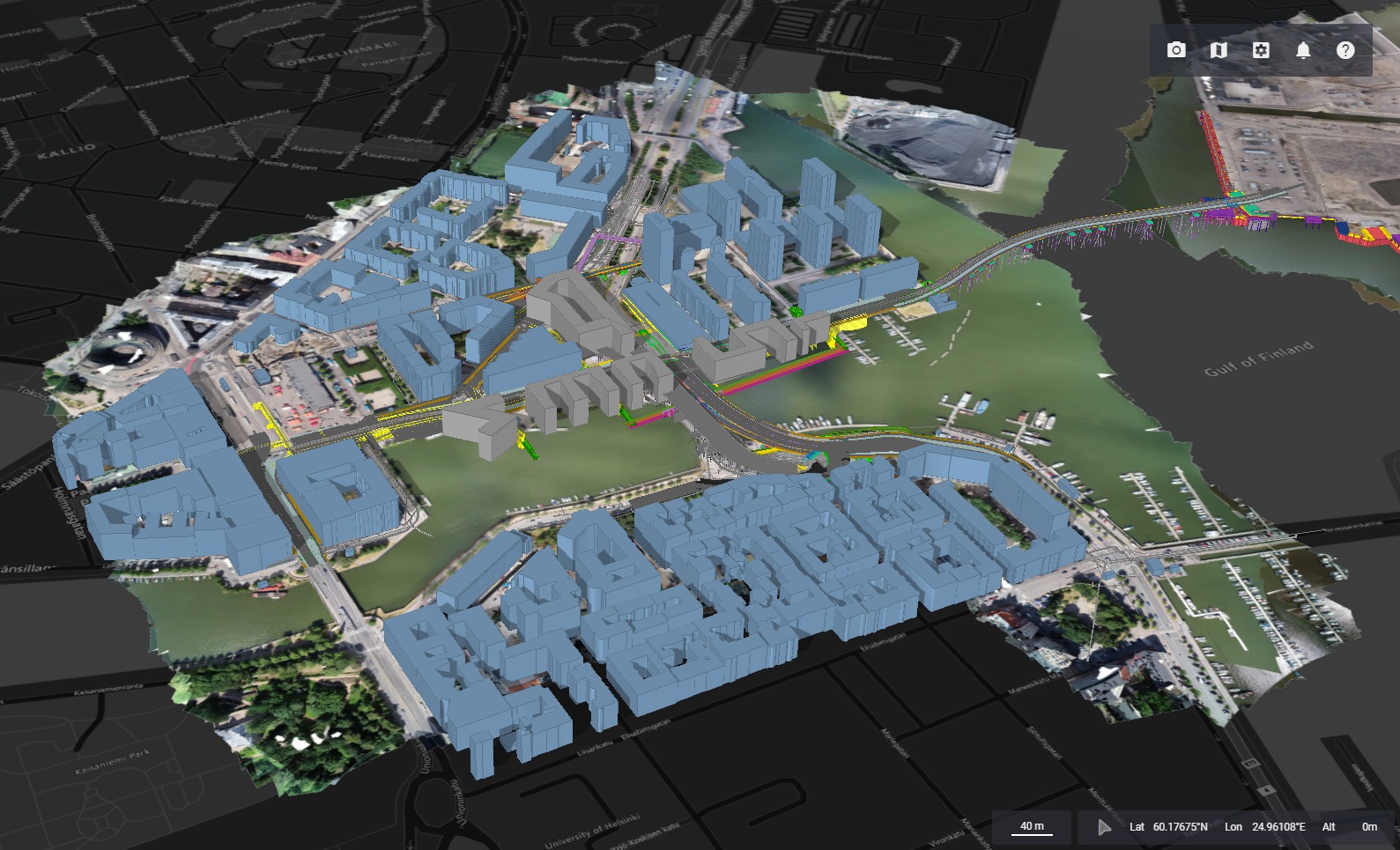
Vektor.io brings together all your project data — BIM models, GIS layers, drone surveys and point clouds — into one clear, easy-to-use view. Everything runs directly in your web browser, with no complex software to install.
Every data format in one view
BIM models, GIS layers, drone surveys and point clouds — Vektor.io brings your entire project dataset into one browser-based environment, without the hassle of converting and re-uploading files.
Six short Vektor.io demos
Each demo shows one everyday workflow — click a card to watch it on Vimeo.
“Having high-quality models from the outset helps us improve our information management process throughout the project lifecycle. This allows us to build traffic networks more efficiently and faster, while unifying our operations.”
— Tarmo Savolainen, BIM Development Manager, Finnish Transport Infrastructure Agency (FTIA)
Vektor.io is integrated into FTIA's Velho system and used on the Highway 4 Kirri–Tikkakoski project.
Who is Vektor.io for?
Contractors and subcontractors
Fast access to drawings, models and surveys straight in the browser. Volume calculations, measurements and quality checks happen in the same environment the whole team works in.
Surveyors and supervisors
Upload drone surveys and point clouds and compare them against the design models. Spot deviations and document results visually and transparently.
Designers and engineers
All the data lives in one place — BIM models, DWGs, GIS layers and surveys. That removes file-version confusion and supports model-based communication with every party.
Clients and owners
Get a clear, up-to-date view of project progress, work quality and any deviations. All the information you need — models, surveys and documentation — sits in one simple view for fast, confident decisions.
Major infrastructure projects trust Vektor.io
Vektor.io is in use at the Finnish Transport Infrastructure Agency, with the Rail Baltica main contractor in Latvia, at Norwegian contractor Vassbakk & Stol (part of the Skanska Norge group), and on the City of Espoo's Finnoo development project.
“We chose Vektor.io because it enables our team to access all design information in one platform, regardless of file format — to view 2D, 3D and survey data together.”
Agnis Mārtiņš Bērziņš
Regional BIM Coordinator, E.R.B. Rail JV PS
“Our key goal is to harmonise our massive data pool. When information from all construction stages is uniform, we can easily utilise it and avoid lapses within the information chain.”
Jenna Ikonen
Infrastructure Modeling Specialist, FTIA
“All our significant ongoing and future projects are pivoting towards being model-based. Hence, it's vital for us to employ a tool that's user-friendly but robust enough to ensure quality and stability throughout the project.”
Trond Huus
Project Developer for Digital Services, Vassbakk & Stol (Skanska Norge)
Real estate developers use Vektor.io to visualise sales statistics and available space directly on the building's 3D model, giving the sales team a real-time view of a specific apartment or area.
Real estate sales management, use case
In use at Estonian companies and across Europe

Book a free demo
Show us your project data and we'll walk through how Vektor.io brings it all together into one clear view. Pricing is quoted based on the scope of your project.
Get in touch