BIM coordination for infrastructures
How does InfraBIM differ from building BIM Coordination?
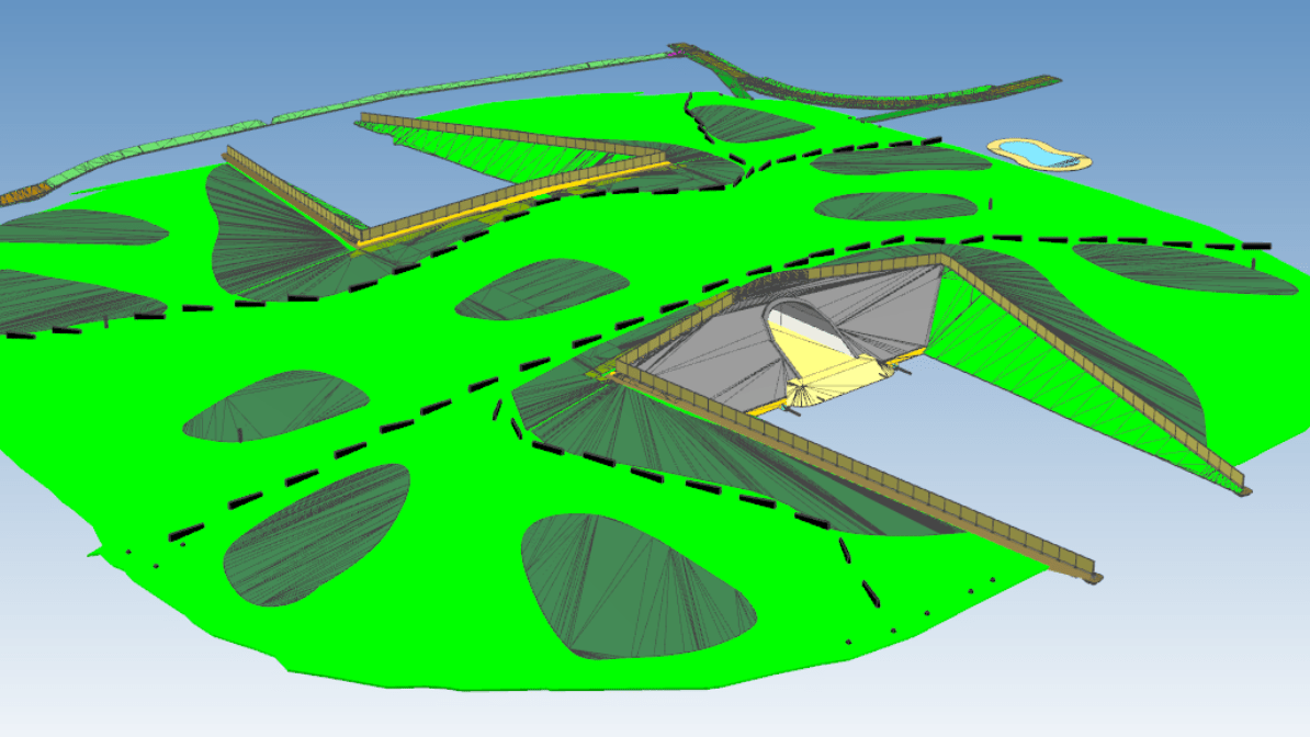
InfraBIM differs from Building BIM both in the software used and in the workflows applied. InfraBIM covers various infrastructure elements such as bridges, roads, railways, and ports. The work is always carried out in a global coordinate system, using Estonia’s L-EST coordinate system and the EH2000 height system. For exchanging surface models and alignments, the open LandXML format is used.
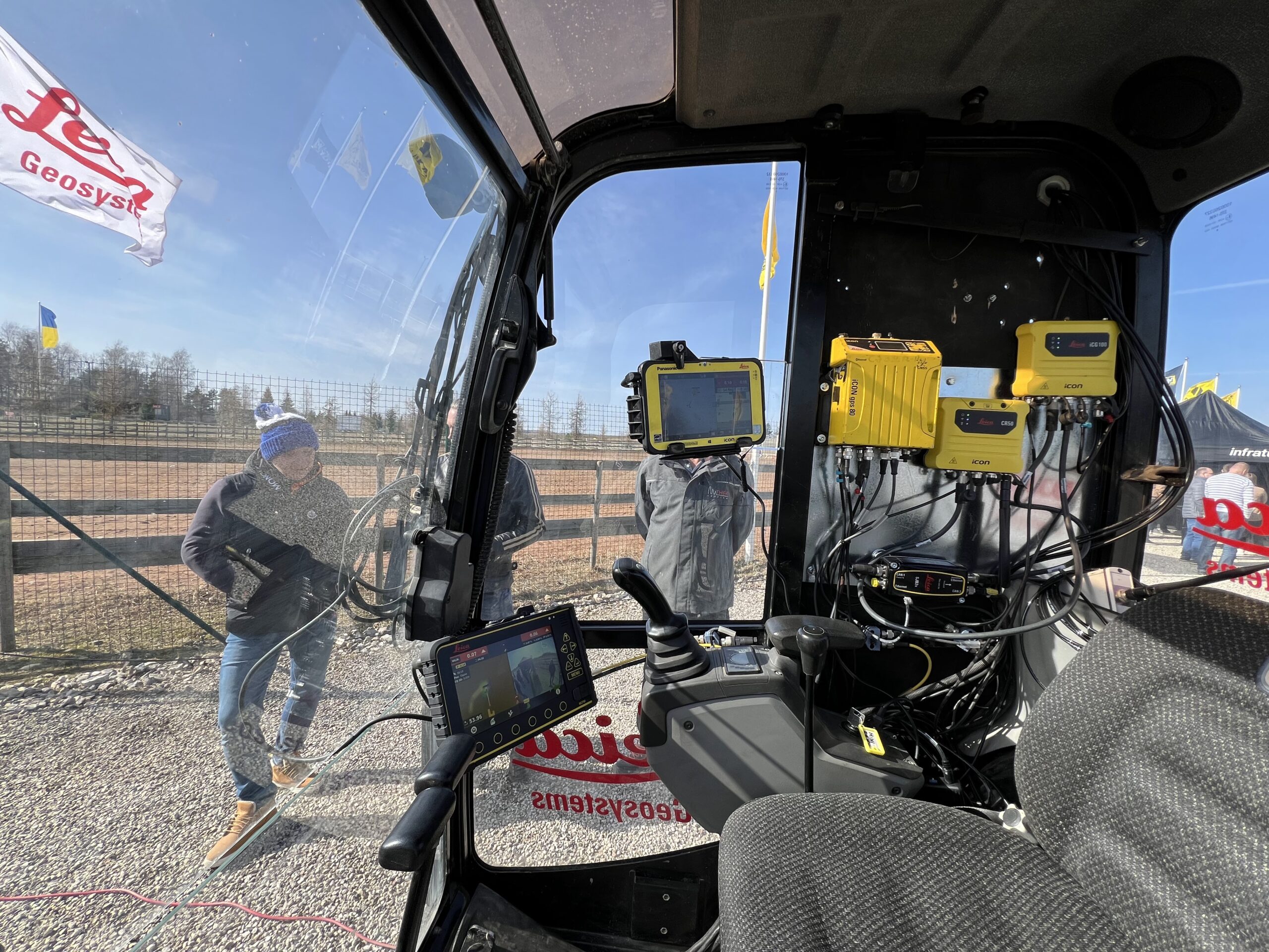
Machine control models have been used in infrastructure for more than a decade, especially in urban areas where excavators and bulldozers equipped with grading systems work directly from the models. However, despite this, the use of models in construction remains limited to a narrow group of specialists, and within construction management teams, the ability to view these models is still low.
About infraBIM
The IFC format is less common in the infrastructure sector because infrastructure models are generally simpler in structure. However, with newer versions such as IFC4x3, IFC has become more widely accepted as it now supports alignments and surfaces.
Civil 3D and Quadri are the main software tools used for creating models. Trimble Connect and Infrakit are key platforms for using models and alignments.
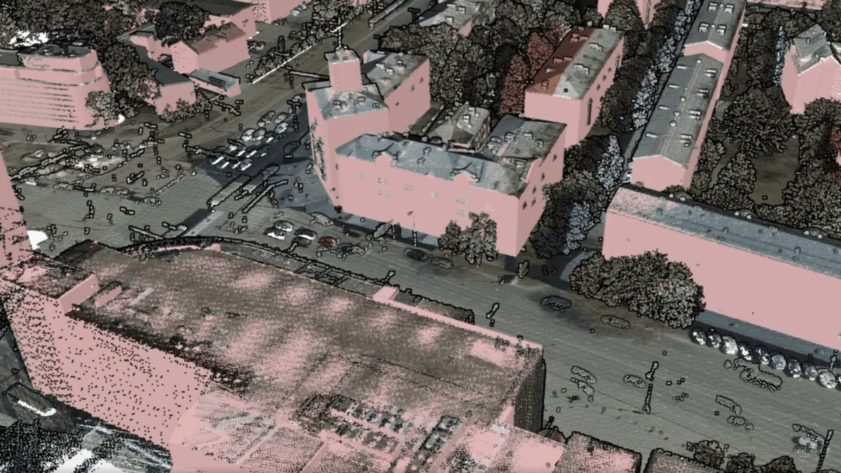
Point clouds, generated by drones, laser scanners, and mobile mapping systems, are a valuable data collection tool. However, they present challenges for coordinators and surveyors, who must manage them in a way that makes them viewable and usable for all stakeholders. The most common open formats for point clouds are .e57, .las, .laz, and .xyz.
InfraBIM brings together geoinformation and engineering solutions!
Our work
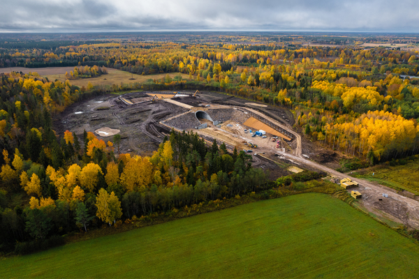
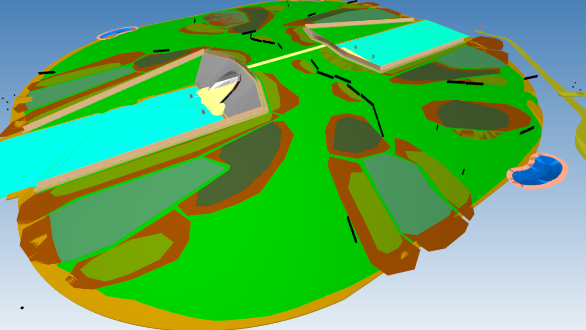
Selja Ecoduct
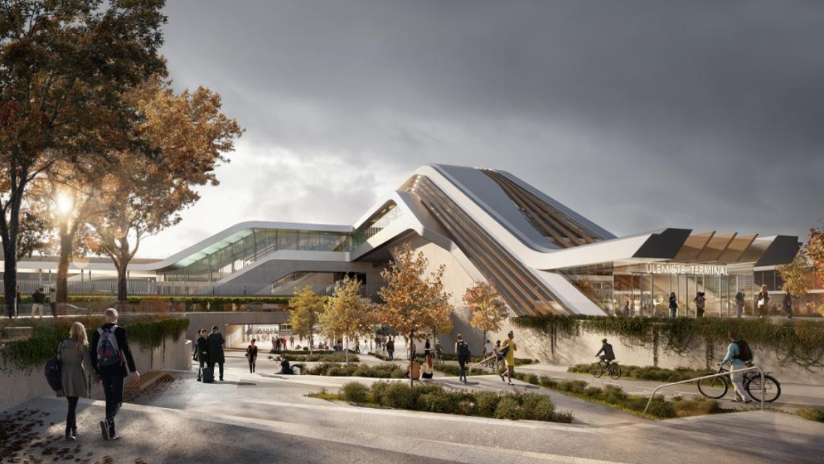
RB Ülemiste Terminal – Stage 1
Reconstruction of Lastekodu Street and Masina Street (Lastekodu St – Tartu Rd)
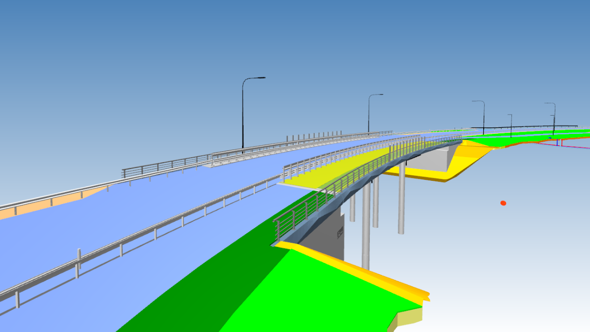
Põrguvälja viaduct
Construction of Lepplaane and Kivisilla Structures